


 Foto:
Foto: Maps
Here you can download maps and information about Färnebofjärden National Park.
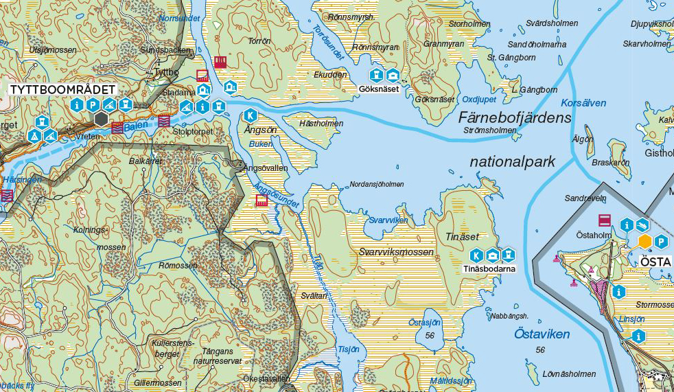
Information Folder with Visitor's Map
This brochure contains information about Färnebofjärden National Park and a visitor's map showing outdoor devices, marked hiking trails, allowed boat speeds etc.
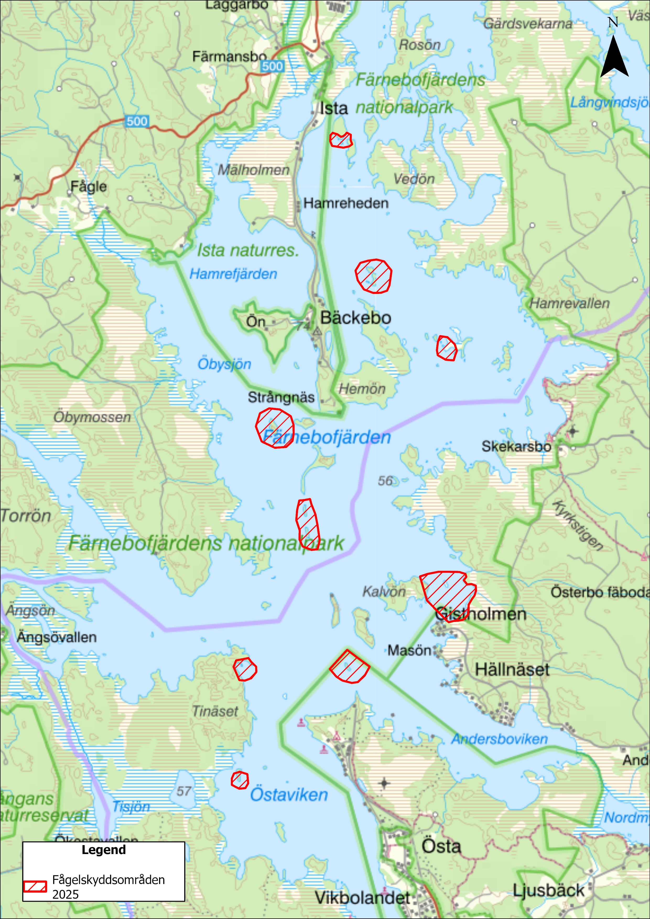
No-access areas in 2025
The osprey is extremely sensitive to disturbances and can leave its young if it feels worried. From 1 January to 31 July, there are therefore temporary access bans in certain areas of the national park. This is to give nesting ospreys but also terns and spawning fish a little extra peace and quiet. To alert visitors to the access ban, we put up signs on land and buoys are placed in the water where the access ban is stated.
A map of the access restricted areas can be downloaded via the link below:
Map of all no-access areas
Share with your friends
Share this page with your friends on Facebook, X (formerly Twitter), Google+ and e-mail.


