


 Foto:
Foto: Maps
Here you can download maps and information about Färnebofjärden National Park.
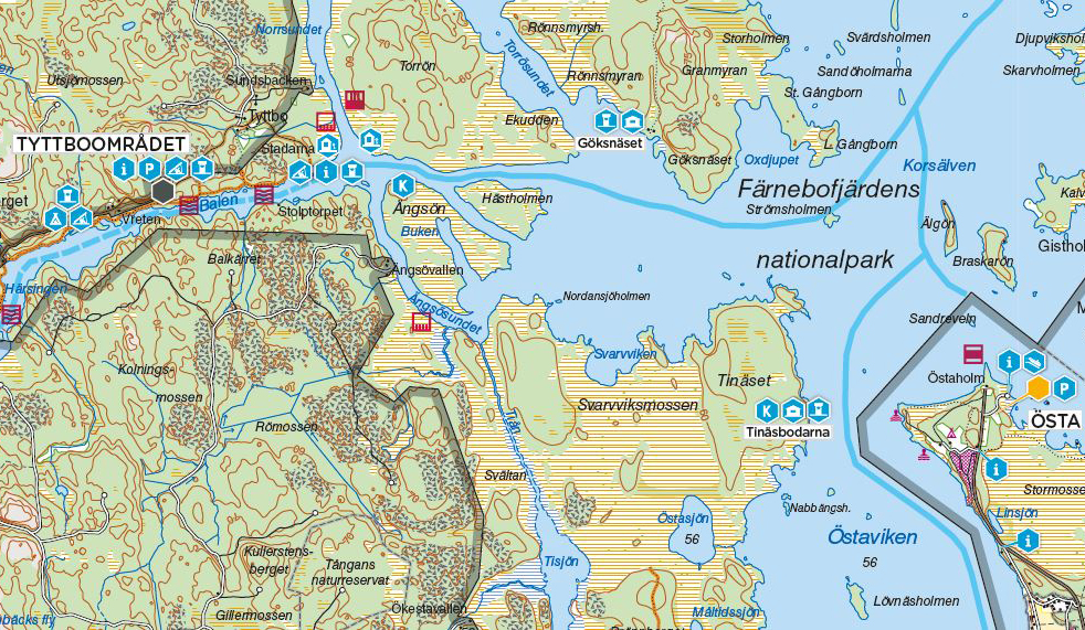
Information Folder with Visitor's Map
This brochure contains information about Färnebofjärden National Park and a visitor's map showing outdoor devices, marked hiking trails, allowed boat speeds etc.
Temporary closed areas 2022
Until the 31 of July 2022 seven areas in the National Park is temporary closed for visitors, to protect nesting birds and spawning fish. These areas are marked in red in the map below. There are floating buoys on the water that mark the closed areas.
Share with your friends
Share this page with your friends on Facebook, X (formerly Twitter), Google+ and e-mail.